Around hydro stations, dams and
surrounding waterways.

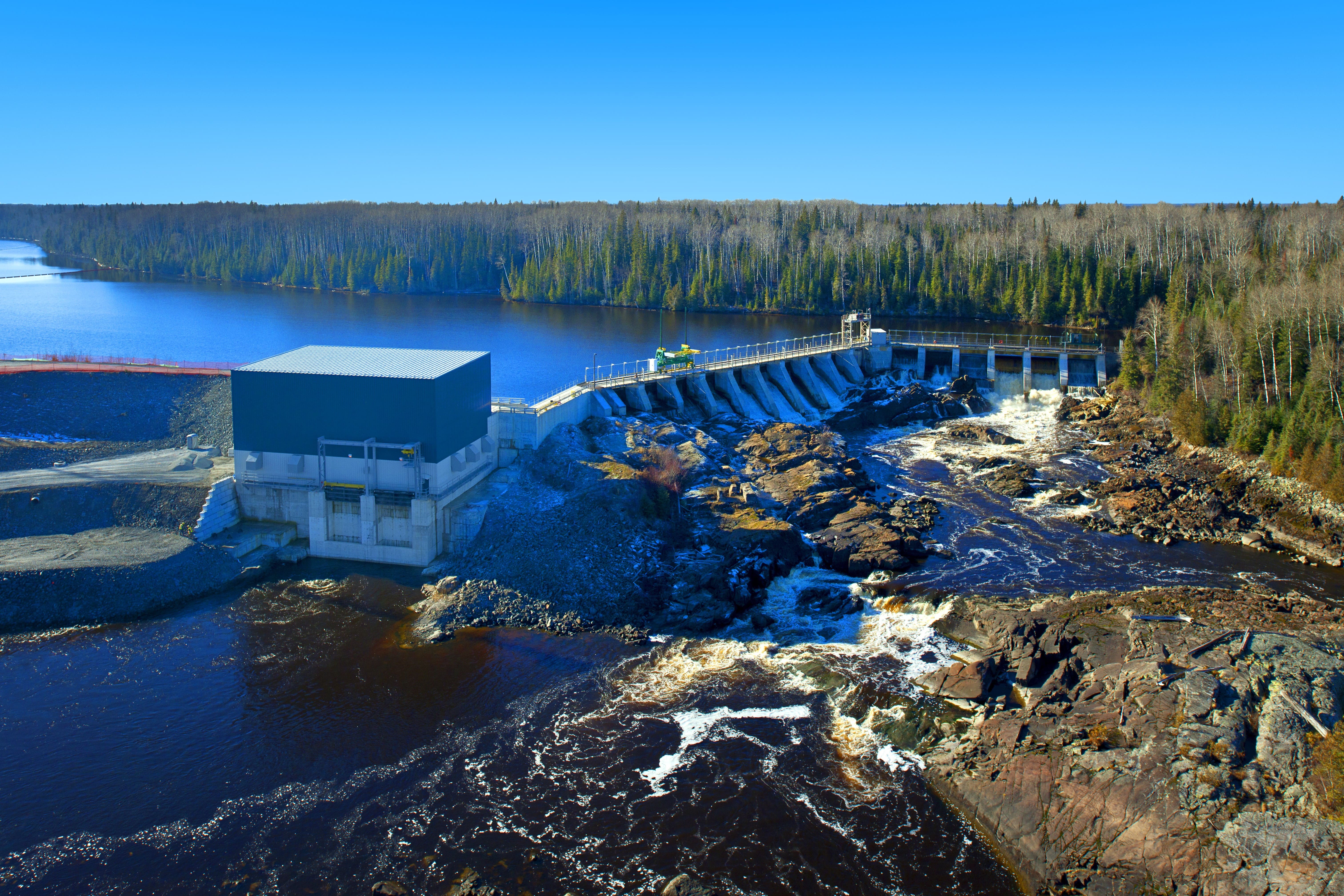
Lower Sturgeon Generating Station
Lower Sturgeon Generating Station is located 48 km northeast of Timmins and began operating in 1923. This run-of-river facility has two units and a maximum generating capacity output of 14 MW. The concrete dam has 16 sluices and a log slide.
SCROLL DOWN
Last 7 Days table
| DATE |
WATER LEVEL (m) |
FLOW (m3/s) |
|---|---|---|
| Nov. 19, 2025 | - | - |
| Nov. 18, 2025 | - | - |
| Nov. 17, 2025 | - | - |
| Nov. 16, 2025 | - | - |
| Nov. 15, 2025 | - | - |
| Nov. 14, 2025 | - | - |
| Nov. 13, 2025 | - | - |
Reading Type
no changed
- no date
Ontario Power Generation Provisional Data
Questions? Please visit the site page on water.opg.com
Data current as of 2025-11-20
Data Disclaimer Statement:
The enclosed information is being released to you for reference purposes only. No part of this information may be produced, published, converted or stored in any data retrieval system, or transmitted in any form or by any means (electronic, mechanical, photocopying, recording, or otherwise) without the prior written permission of Ontario Power Generation Inc.
Neither Ontario Power Generation Inc. nor its subsidiaries, employees, officers, directors or agents makes any representation or warranty, express or implied, as to the accuracy or correctness of the enclosed information and disclaims any and all liability for any consequences as a result of, or in any way related to, the reproduction or use of this information in whole or in part.